


Voting District 0109, Ector County, Texas
About
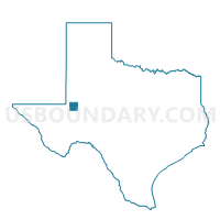
Outline

Summary
| Unique Area Identifier | 672719 |
| Name | Voting District 0109 |
| County | Ector County |
| State | Texas |
| Area (square miles) | 483.62 |
| Land Area (square miles) | 481.77 |
| Water Area (square miles) | 1.85 |
| % of Land Area | 99.62 |
| % of Water Area | 0.38 |
| Latitude of the Internal Point | 31.90809930 |
| Longtitude of the Internal Point | -102.63531340 |
Maps


Graphs
Select a template below for downloading or customizing gragh for Voting District 0109, Ector County, Texas


Neighbors
Neighoring Voting District (by Name) Neighboring Voting District on the Map
- Voting District 0001, Andrews County, TX
- Voting District 0002, Ward County, TX
- Voting District 0003, Crane County, TX
- Voting District 0004, Andrews County, TX
- Voting District 0101, Ector County, TX
- Voting District 0102, Ector County, TX
- Voting District 0103, Ector County, TX
- Voting District 0105, Ector County, TX
- Voting District 0108, Ector County, TX
- Voting District 0110, Ector County, TX
- Voting District 0207, Ector County, TX
- Voting District 0301, Winkler County, TX
- Voting District 0401, Winkler County, TX
- Voting District 0404, Ector County, TX
Top 10 Neighboring County Subdivision (by Population) Neighboring County Subdivision on the Map
- Odessa CCD, Ector County, TX (111,306)
- West Odessa-Goldsmith CCD, Ector County, TX (25,824)
- Monahans CCD, Ward County, TX (9,555)
- Kermit CCD, Winkler County, TX (6,120)
- Andrews South CCD, Andrews County, TX (2,711)
- Crane North CCD, Crane County, TX (1,257)
Top 10 Neighboring Place (by Population) Neighboring Place on the Map
Top 10 Neighboring Unified School District (by Population) Neighboring Unified School District on the Map
- Ector County Independent School District, TX (137,130)
- Andrews Independent School District, TX (14,786)
- Monahans-Wickett-Pyote Independent School District, TX (9,697)
- Kermit Independent School District, TX (6,108)
- Crane Independent School District, TX (4,375)
- Wink-Loving Independent School District, TX (1,084)
Top 10 Neighboring State Legislative District Lower Chamber (by Population) Neighboring State Legislative District Lower Chamber on the Map
- State House District 82, TX (163,234)
- State House District 81, TX (159,026)
- State House District 74, TX (143,566)
Top 10 Neighboring State Legislative District Upper Chamber (by Population) Neighboring State Legislative District Upper Chamber on the Map
Top 10 Neighboring 111th Congressional District (by Population) Neighboring 111th Congressional District on the Map
Top 10 Neighboring Census Tract (by Population) Neighboring Census Tract on the Map
- Census Tract 27, Ector County, TX (9,601)
- Census Tract 30, Ector County, TX (8,541)
- Census Tract 9501, Crane County, TX (4,375)
- Census Tract 28.01, Ector County, TX (4,086)
- Census Tract 9501, Ward County, TX (4,037)
- Census Tract 8, Ector County, TX (3,528)
- Census Tract 25.01, Ector County, TX (3,440)
- Census Tract 22, Ector County, TX (3,117)
- Census Tract 1, Ector County, TX (3,084)
- Census Tract 9504, Andrews County, TX (2,711)
Top 10 Neighboring 5-Digit ZIP Code Tabulation Area (by Population) Neighboring 5-Digit ZIP Code Tabulation Area on the Map
- 79762, TX (39,056)
- 79763, TX (34,079)
- 79764, TX (20,725)
- 79714, TX (14,786)
- 79756, TX (9,066)
- 79765, TX (6,927)
- 79745, TX (6,125)
- 79766, TX (6,115)
- 79758, TX (2,197)
- 79741, TX (288)